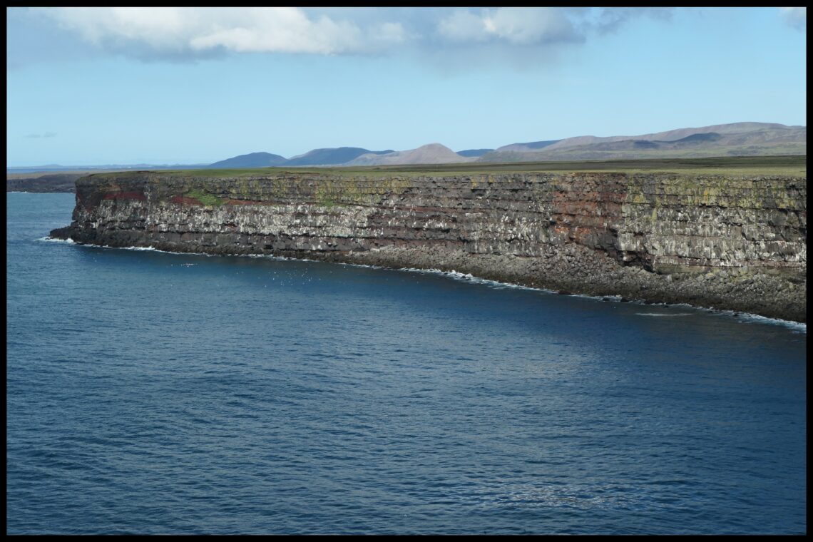
The cliffs of Krýsuvíkurbjarg (sometimes also called Krýsuvíkurberg) on the south coast of Reykjanes are already spectacular. And there is more to see.
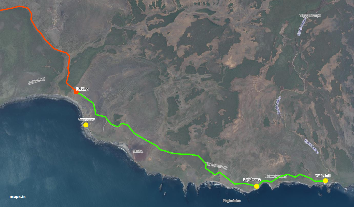
The access to the cliffs is approx. 19 km after Grindavík (or 38 km after Þorlákshöfn) on road 427 Suðurstrandarvegur (GPS 63.854081, -22.103135), there is a small signpost that can easily be overlooked. From there, a 3 km long gravel road leads to a parking lot. During my visit the route was easy to drive, but when it rains it could get very muddy and sometimes there is a waterhole about halfway that could prevent smaller cars from going further. If the conditions are good a 4×4 is not absolutely necessary. If in doubt, leave the car at the junction or at said waterhole.
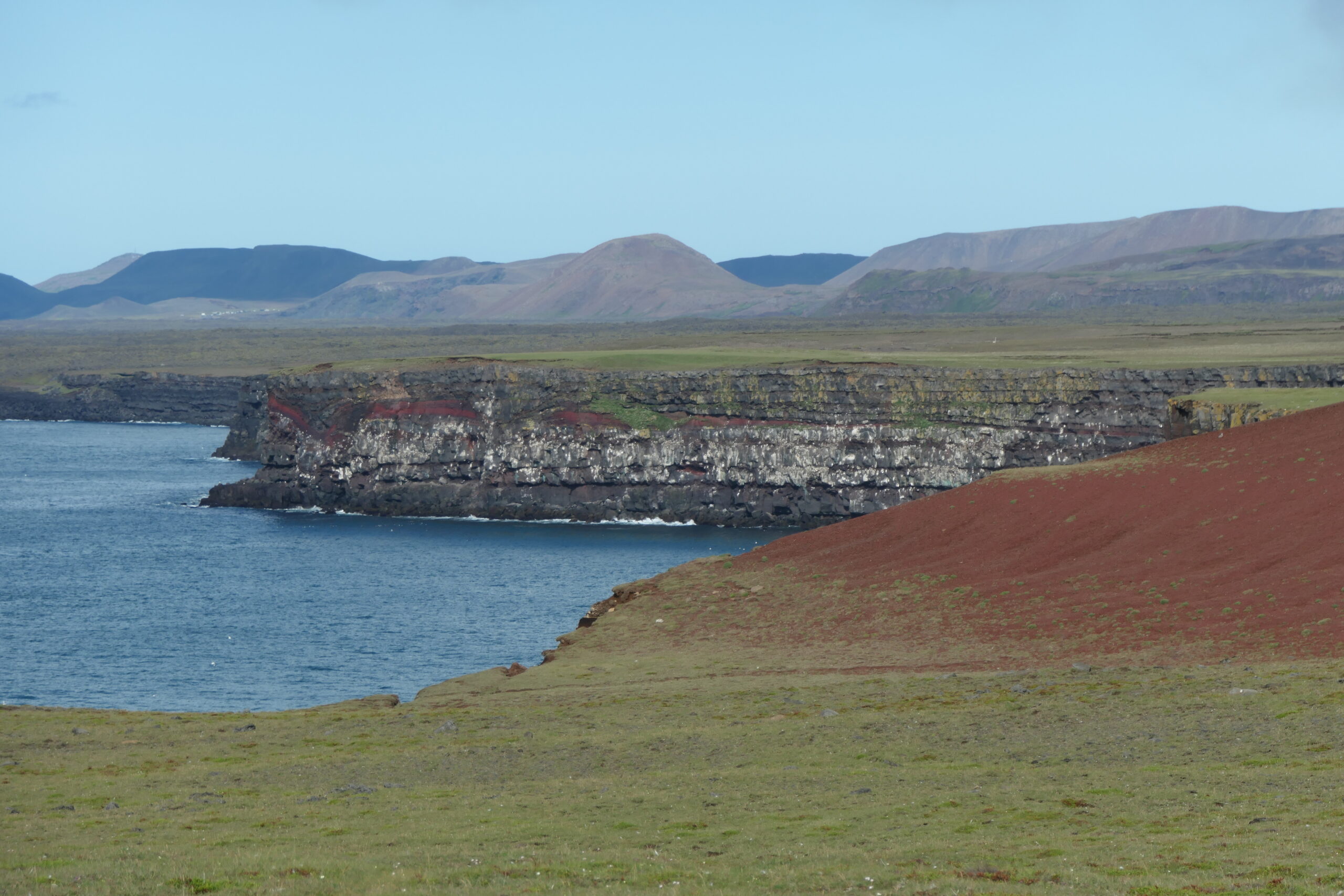
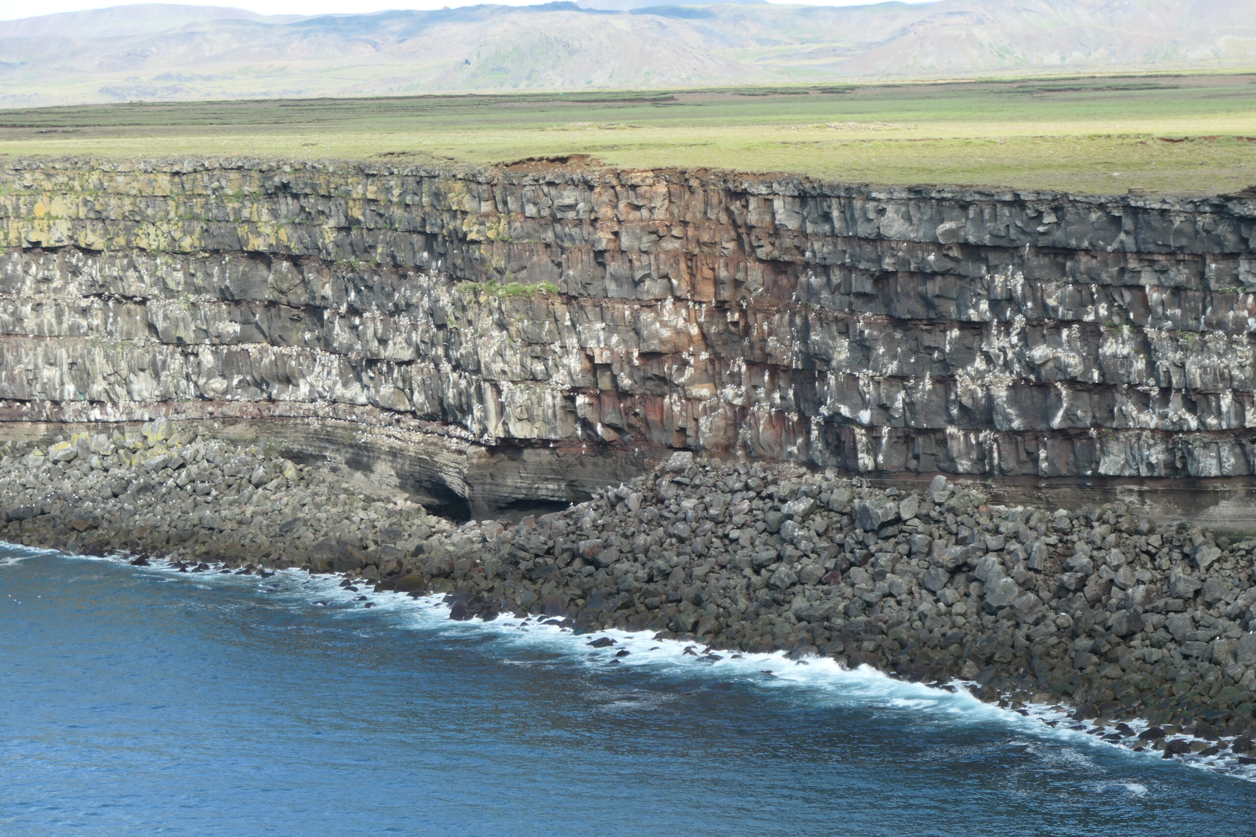
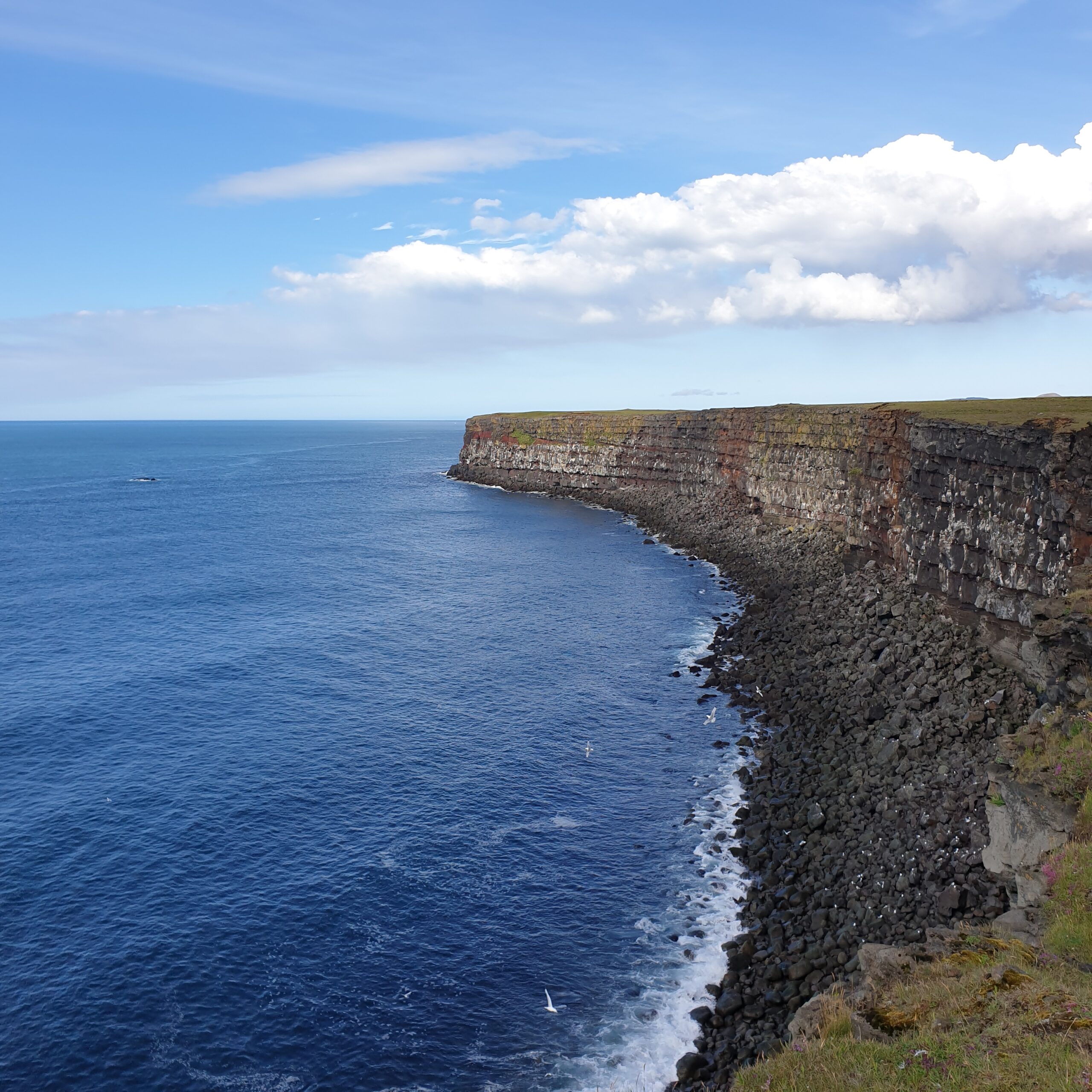
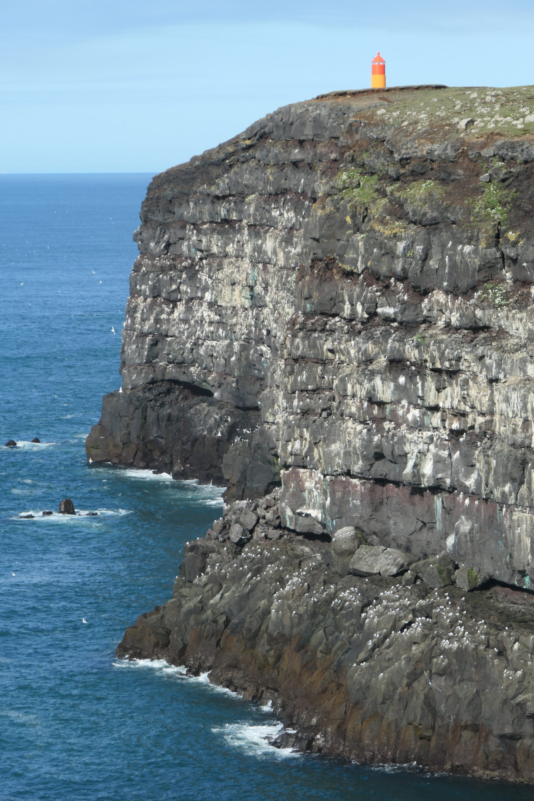
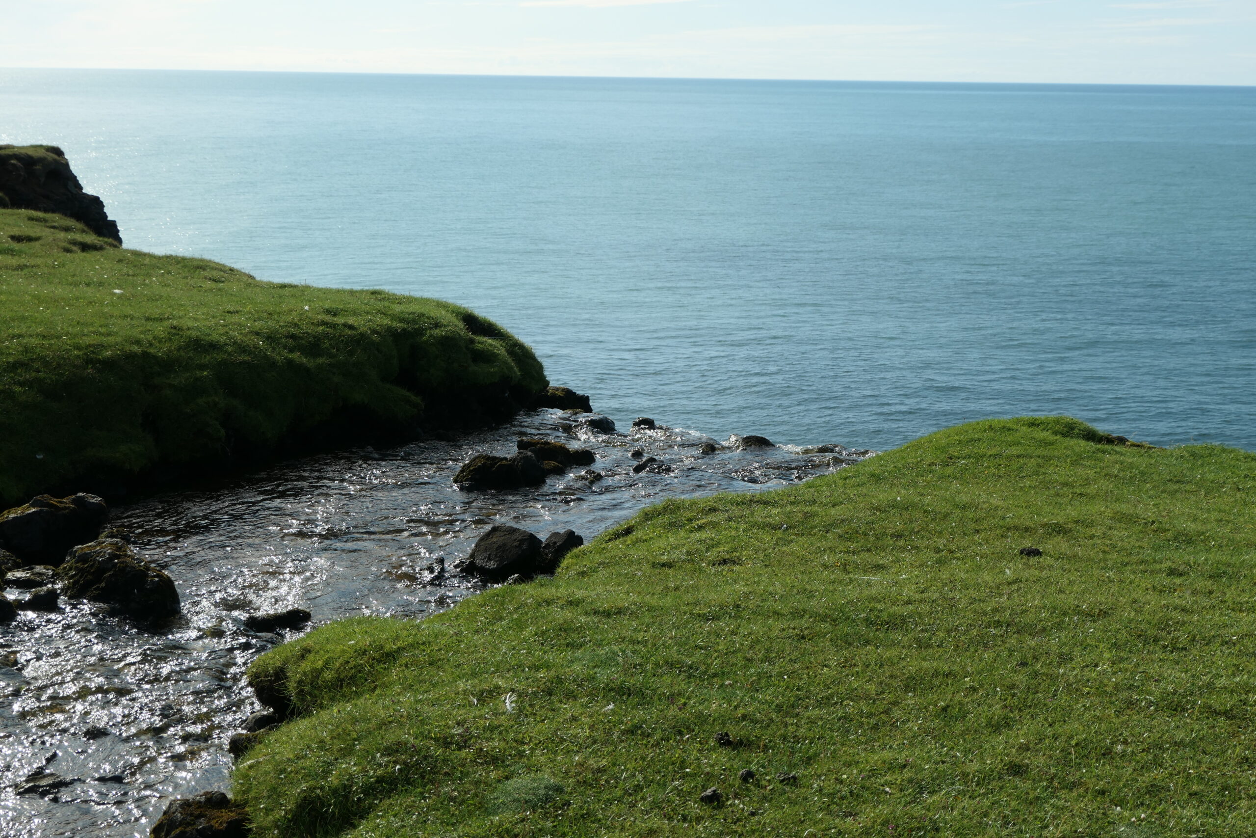
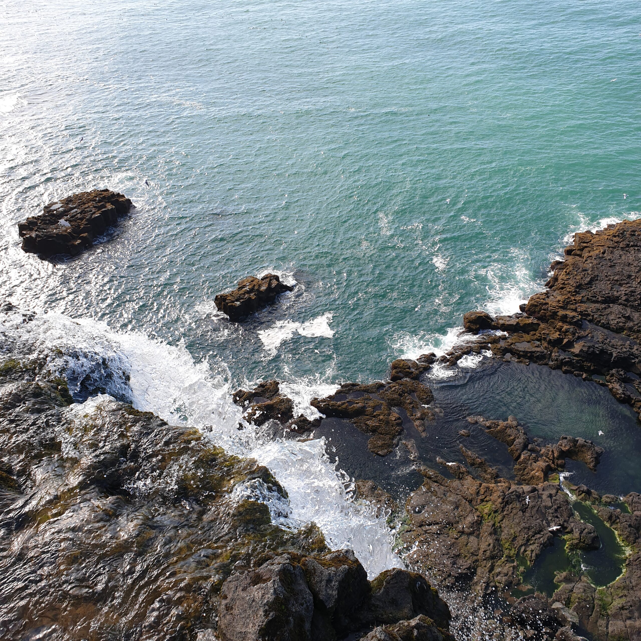
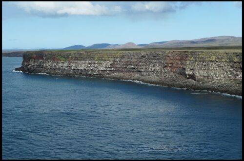
The dramatic rock faces are around 15 km long and up to 70 meters high. A walk along the cliffs is a great way to see several layers of lava that have overlapped during past volcanic eruptions. Parts of Krýsuvíkurbjarg (cliffs and ground) glow in an incredible red.
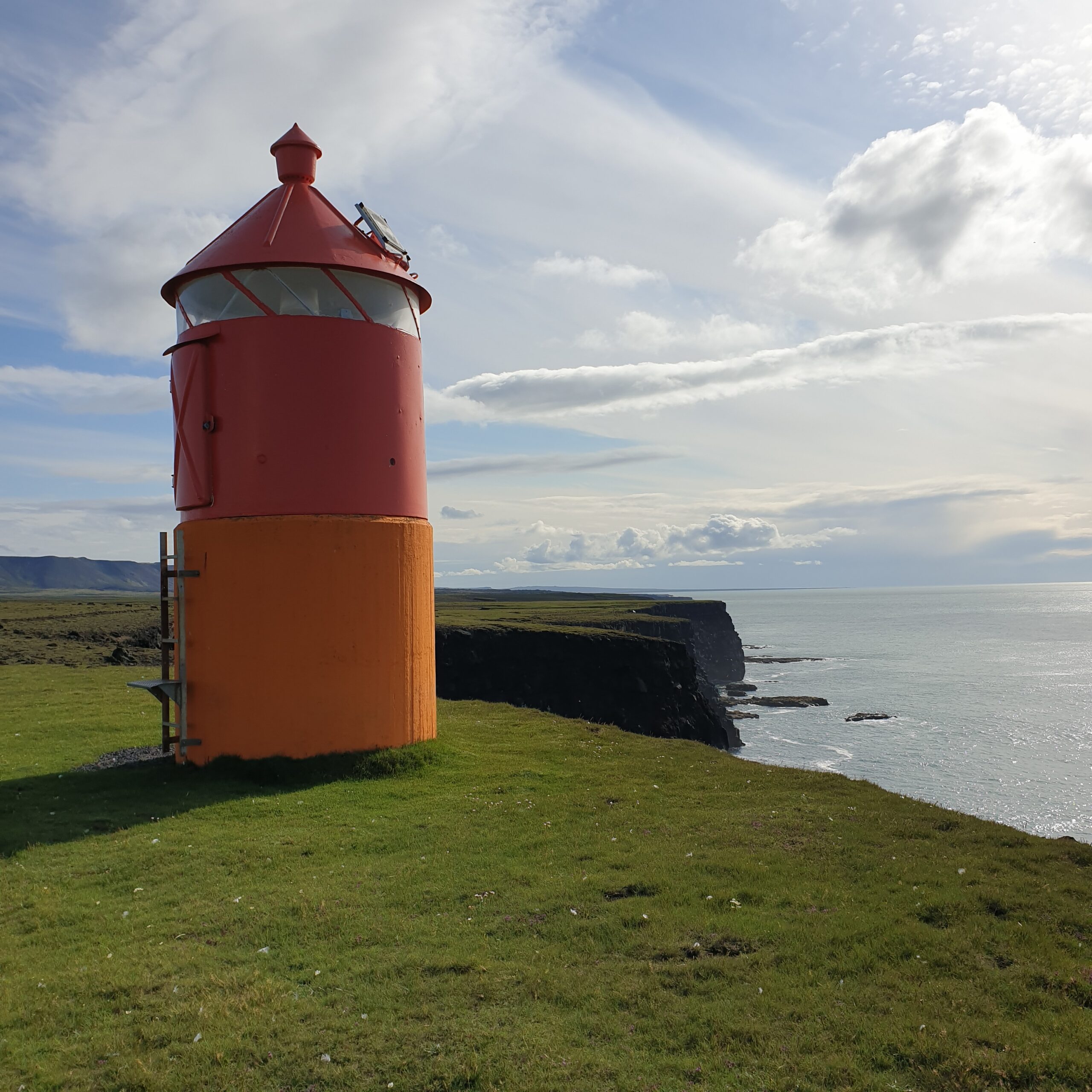
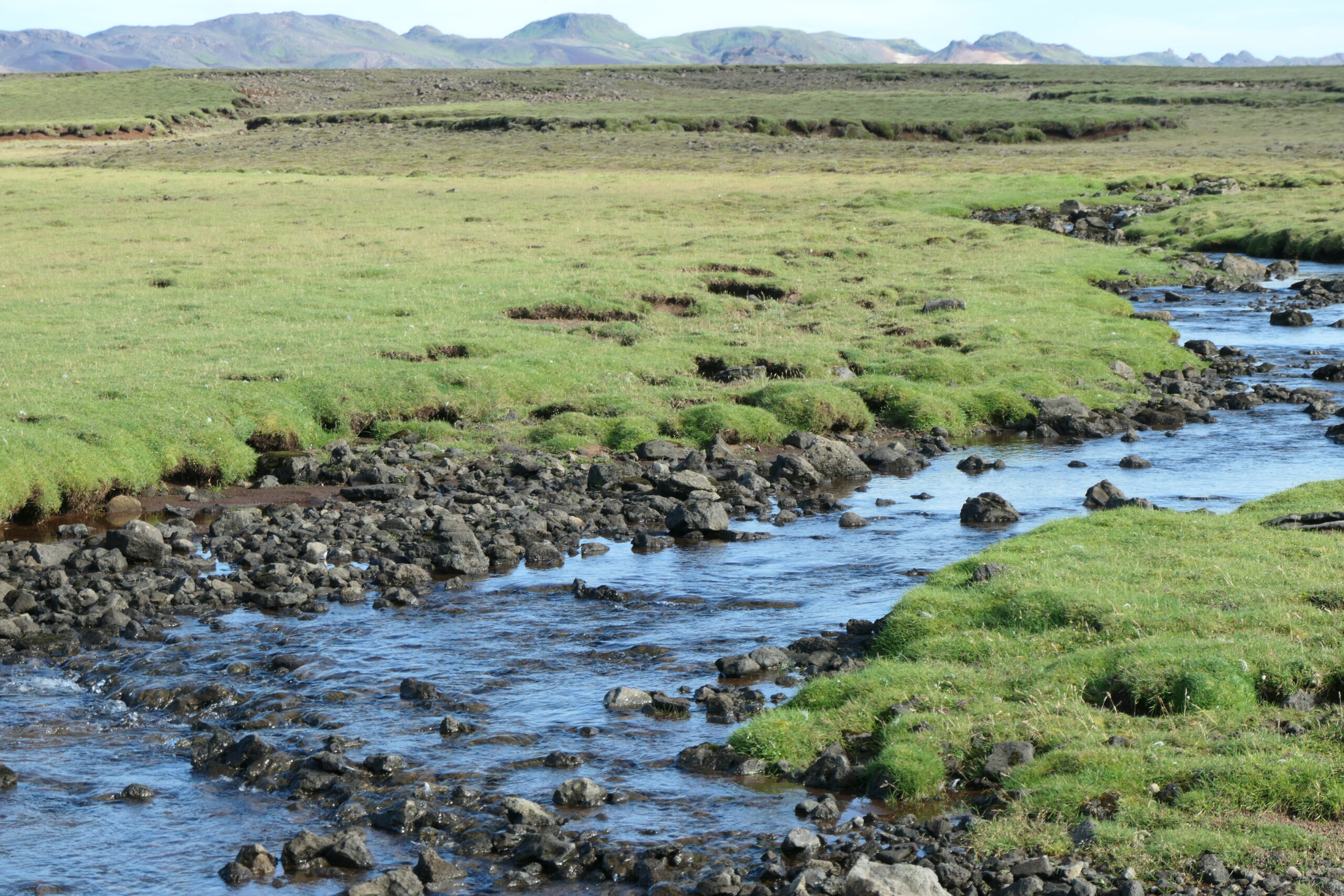
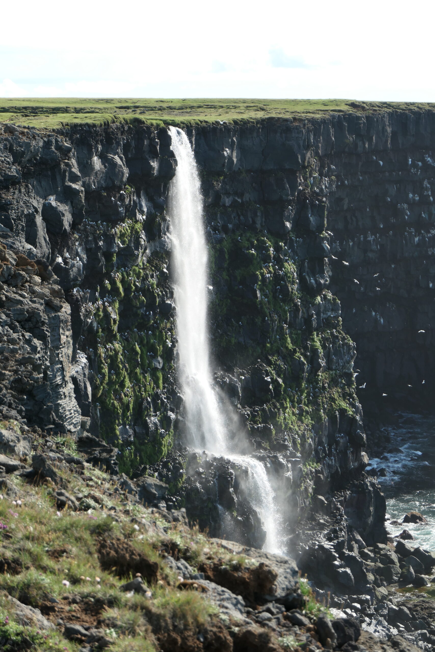
From the parking lot you follow an old jeep track (now definitely no longer passable by cars) along the cliffs. After 1.7 km you will reach a pretty little lighthouse. It is a wonderful place to relax, but be careful when the wind is strong and don’t go too close to the edge as parts can also break off. If you continue further, after another 650 meters you will reach one of the only two waterfalls on the peninsula. The river is called Eystri-lækur (“eastern creek”), the waterfall itself has has no name but is sometimes called Krýsuvíkurfoss. Most visitors turn around at this point but it is possible to follow a path for another 3 km.
If you go west from the parking lot, after about 1 km you will reach Vestrilækur (“western creek”), where the second waterfall is located. The small pebble beach with a view of the waterfall is unfortunately not accessible and only clearly visible from the sea (or with a drone). Since both streams are very small, it can also happen that they have too little water and the waterfalls dry up.
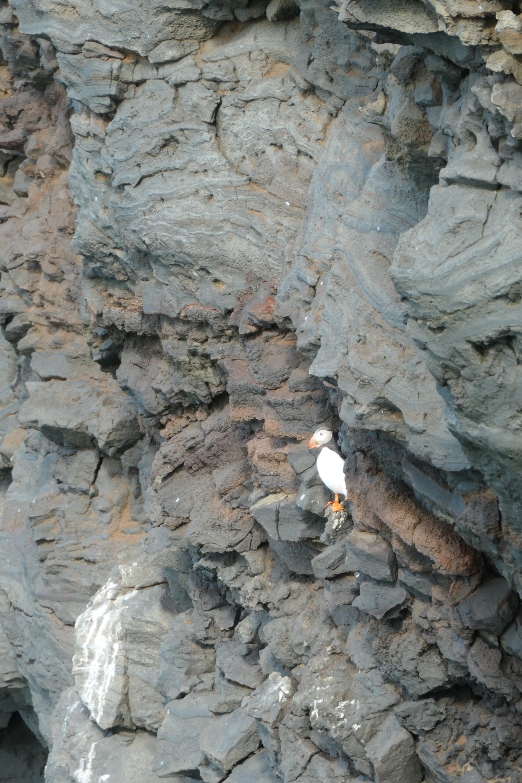
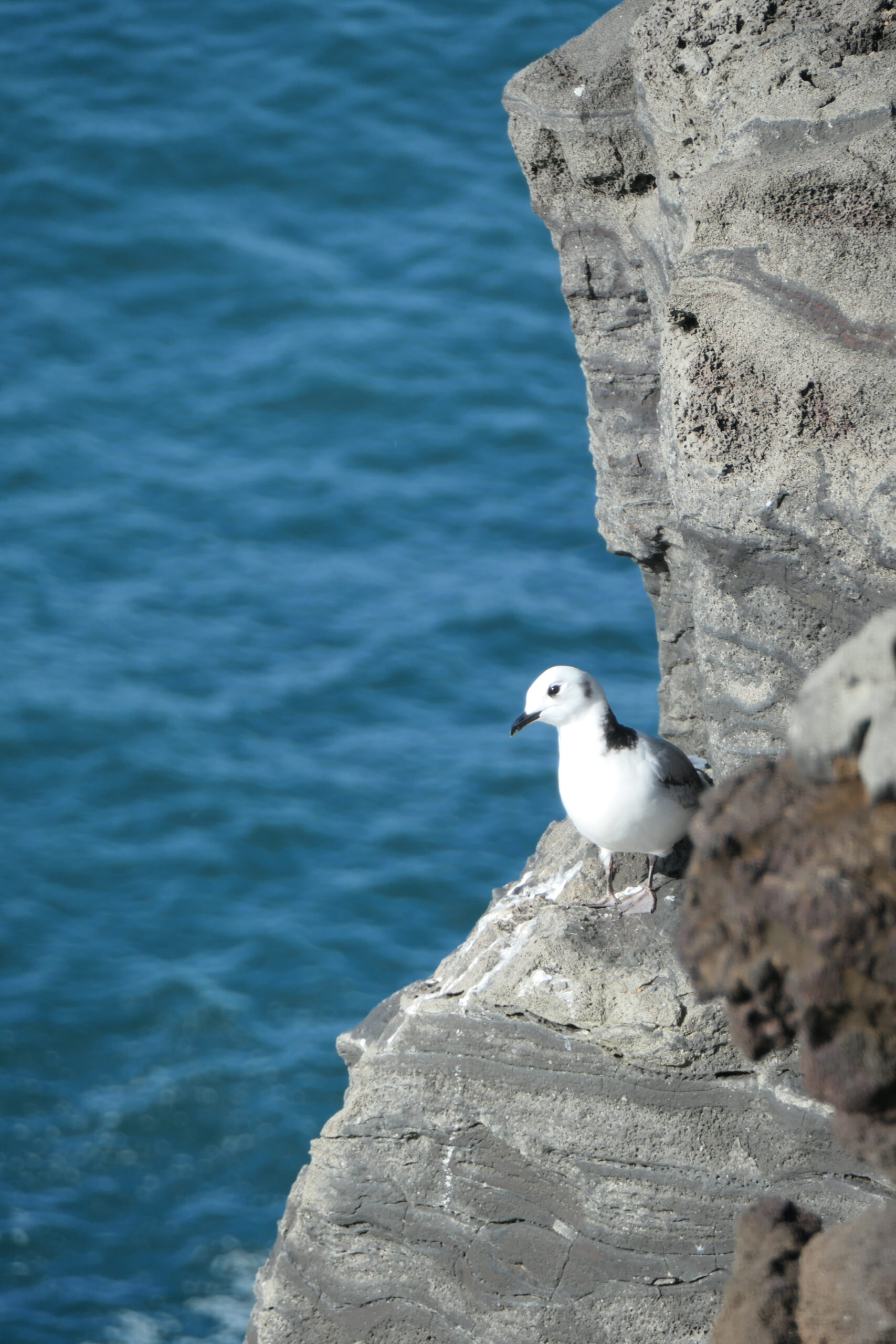
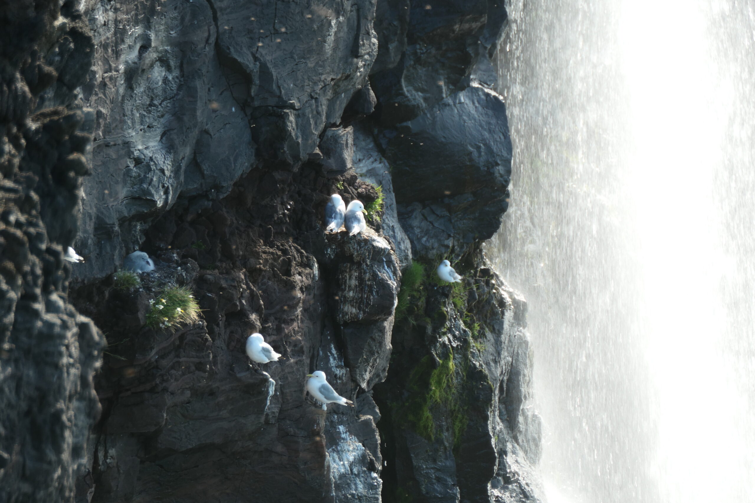
The best time to visit is in summer from May to September, when the most birds can be seen. Around 60,000 birds breed here, including fulmars, guillemots, razorbills and kittiwakes. Also a few pairs of puffins are there but the rocky cliffs are not very suitable for the burrows they dig in the ground for their nests and therefore the area is not very popular with them.
In the summer of 1627, Muslim pirates from the Mediterranean sea attacked Iceland, murdering and enslaving hundres of people. The steep rock faces are rather difficult to reach, but the buccaneers found a small landing and got from there up to the plateau, which has been given the name Ræningjastígur (“raiders trail”). According to a legend, when the pirates came up the cliffs, the local priest cursed them, whereupon they started to fight and killed each other. Above the landing, some remains of an old farmstead named Eyri (and allegedly also the mounds of the pirates graves) can be made out.